
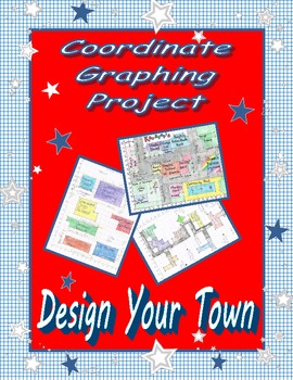
I am always looking for a high-interest way to have my students work with coordinate graphing. My students always love the pictures they can make using ordered pairs, which we did, but I wanted something with higher level thinking and application. I found such an activity on teacherspayteachers.com, called Design Your Town.
Today, our focus was just on creating the map using grid paper. The students:
- Labeled and numbered their x and y-axis.
- Drew and labeled 7 buildings.
- Plotted and labeled 4 points of interest.
- Included a compass rose.
- Creatively named the town.
- Included streets between the buildings.
- Added color.
I am going to tweak the activity a little tomorrow and throw in some technology.... you'll have to check back!
We finished off our math class by completing a Countdown to STAAR. Out test in on April 20 (12 school days).
No comments:
Post a Comment